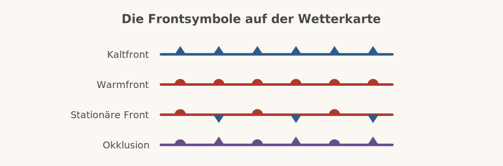
A front is the boundary between two air masses of different temperature and humidity. Because the two do not want to mix, one pushes over or under the other – and that is exactly where the weather happens. There are four types.
1. The cold front
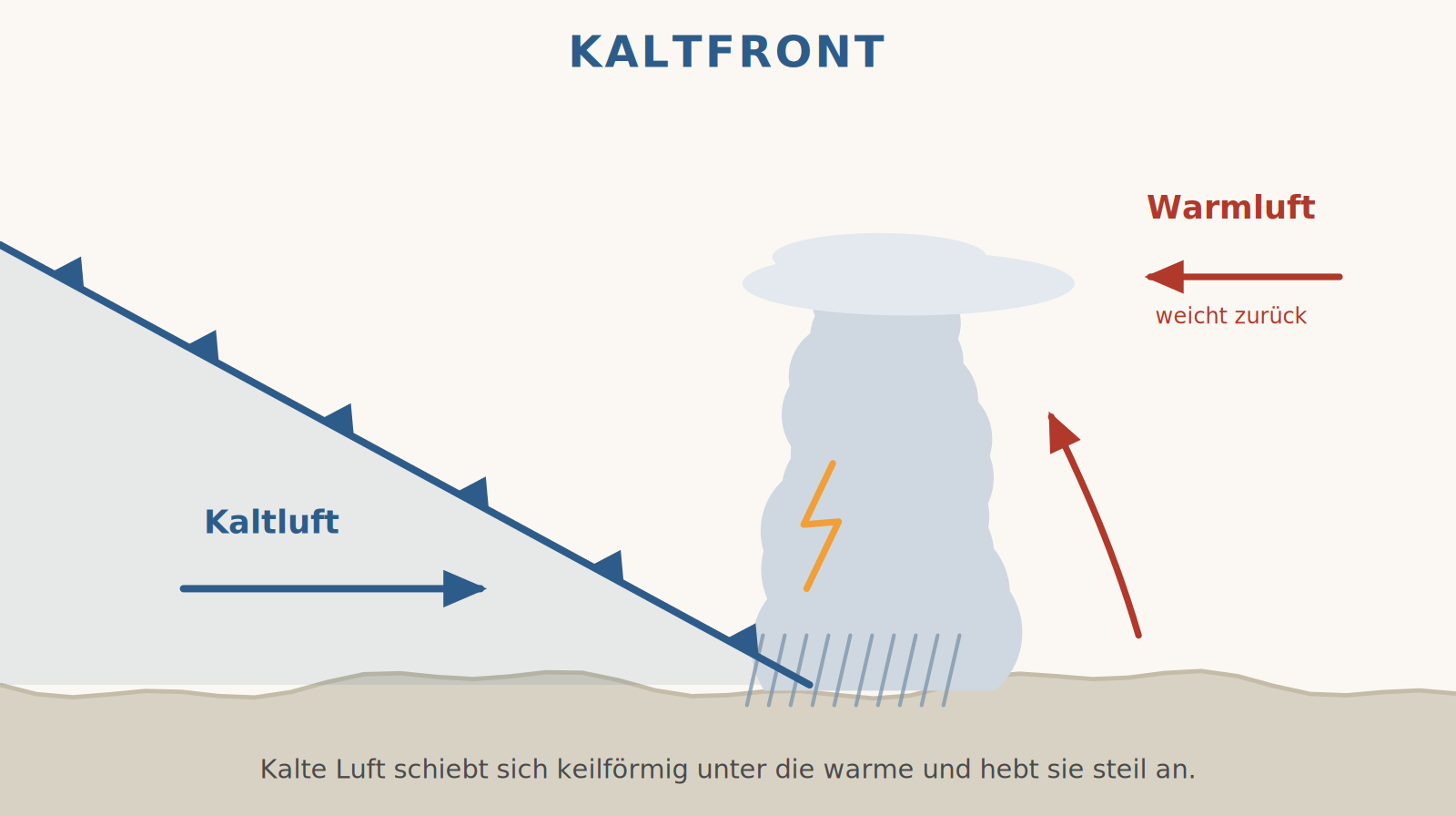
Cold, heavy air pushes like a wedge under the warm air and lifts it. Because the leading edge is steep, this happens quickly and in a narrow space: towering cumulus clouds form, up to cumulonimbus, with showers, gusts and thunderstorms. The spectacle rarely lasts long – after the passage the wind veers, the temperature drops and visibility often becomes excellent.
2. The warm front
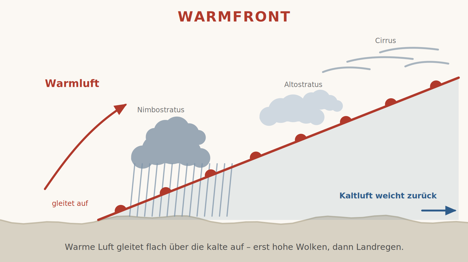
Conversely, warm air glides up over a retreating cold air mass. The sloping surface is very shallow – over 100 kilometres it rises only a few hundred metres. That is why a warm front announces itself well in advance: first cirrus, then cirrostratus with a halo, then altostratus, and finally nimbostratus with persistent steady rain. The pressure falls ahead of the front and settles after the passage; the temperature rises.
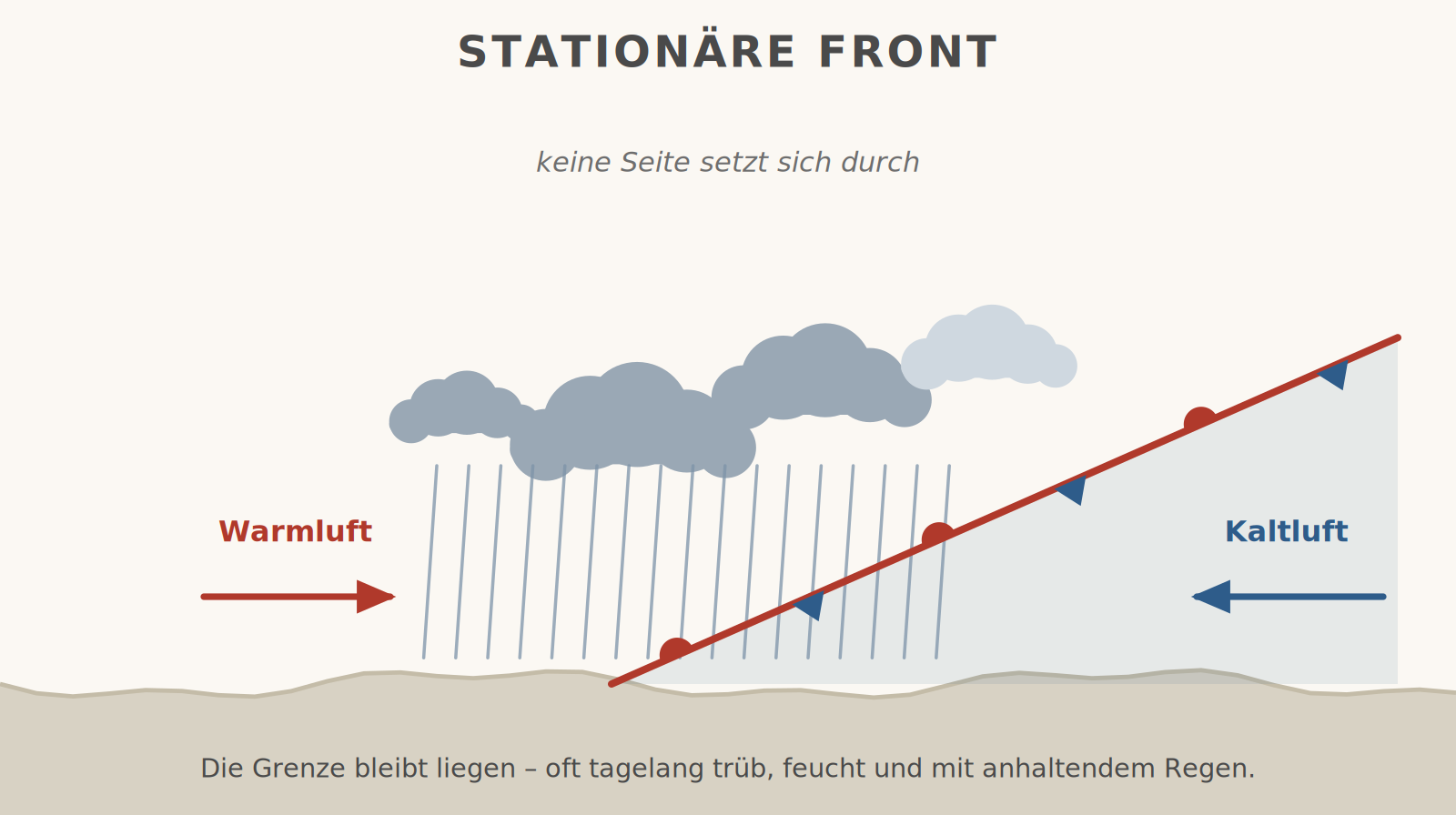
3. The stationary front
If two air masses meet without either prevailing, the boundary stays put. The weather resembles a weak warm front – except that it does not move on: solid cloud cover, drizzle or persistent rain, dull and damp, often for days. For flight planning this is the most thankless situation, because no improvement is in sight.
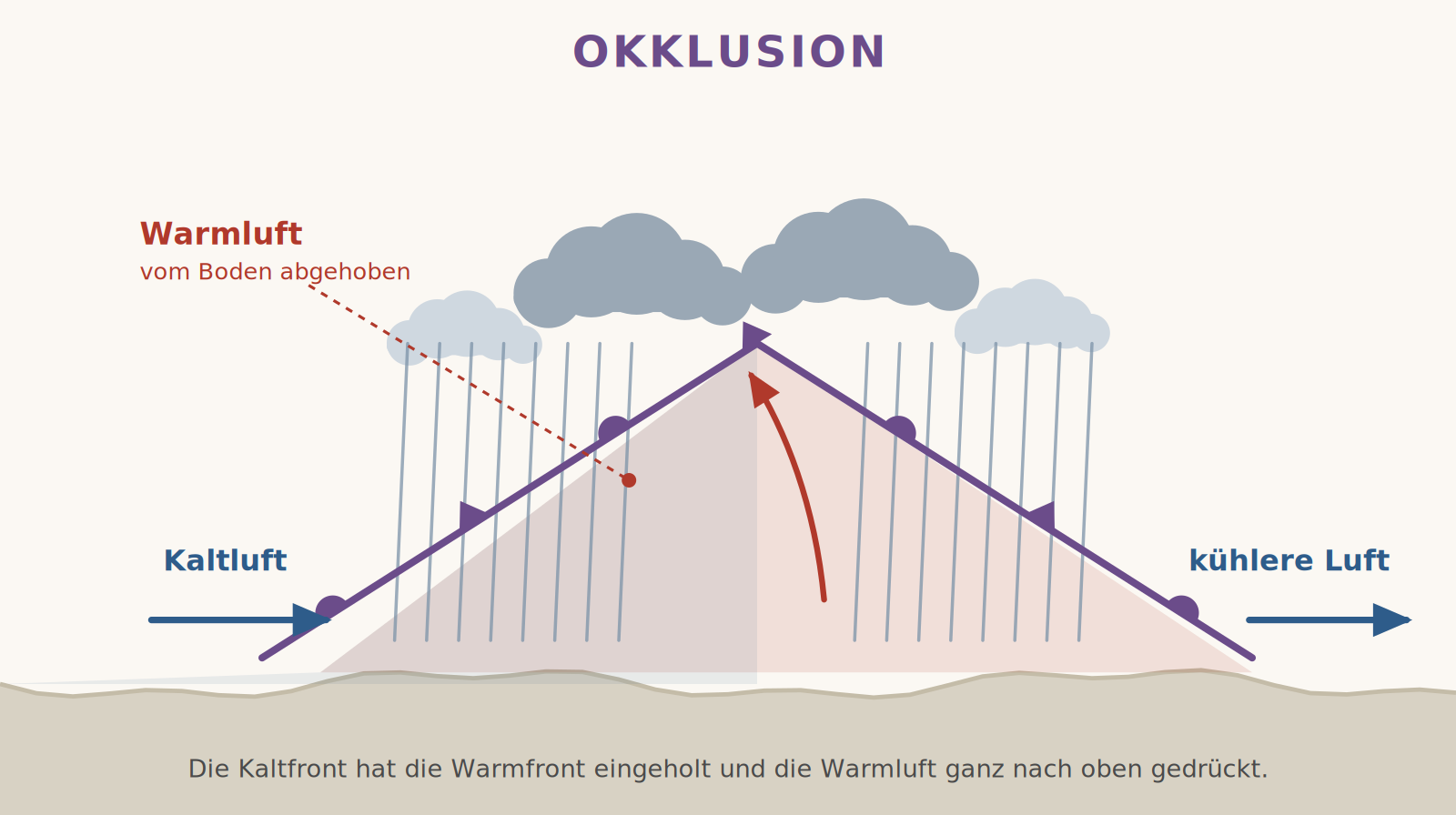
4. The occlusion
Cold fronts are faster than warm fronts. When one catches up with the other, the warm air is lifted completely off the ground – the front is occluded. At the ground only two cold air masses meet; the weather combines features of both fronts: widespread cloud, extensive precipitation and, depending on the type, showers too. The occlusion is the sign that a low has passed its peak.
How it all connects
The four types of front are not separate phenomena but stages in the life of a low. A wave on the stationary polar front develops into a low with a warm and a cold front. The warm sector between them becomes ever narrower until the cold front catches up with the warm front – the low occludes and fills. That is why fronts in central Europe almost always pass in this order: warm front, warm sector, cold front.
What this means for a flying day
- A warm front means: be patient. It brings low, solid ceilings, poor visibility, drizzle and often fog – for many hours.
- A cold front means: short but serious. Squalls, wind shifts of 60° and more, shear on the approach. Afterwards it is often the best day of the week.
- The warm sector is deceptive. Between the two fronts it becomes mild and the clouds break up – but the cold front is already waiting behind.
- Cirrus in the morning is an early warning. It runs about a day ahead of the warm front. When it thickens into cirrostratus with a halo, the front is on its way.
- Fronts are not lines but zones. The chart shows the surface position; aloft the front is further ahead, and its weather often begins 100 kilometres before the line drawn on the chart.