For VFR flying, visibility is the hardest limit of all – harder than wind, harder than cloud base. And it is the quantity that changes fastest. A look at two numbers in the weather report tells you almost everything: temperature and dew point.
Dew point and spread
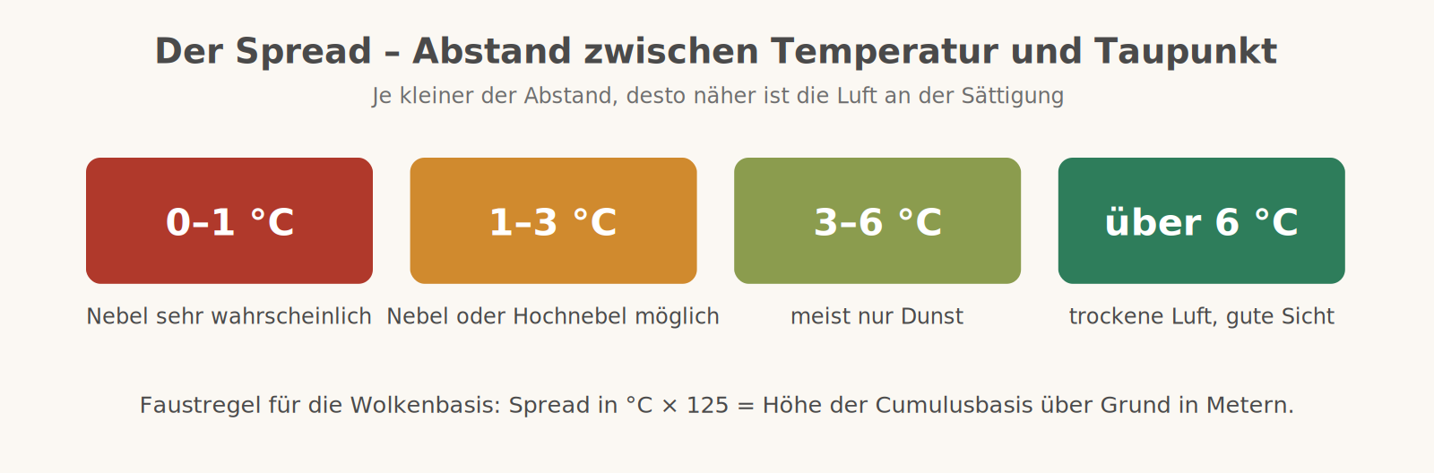
The dew point is the temperature to which air must cool for its moisture to condense. The difference between air temperature and dew point is called the spread. It is the measure of how far the air is from saturation – and therefore the best short-range fog forecast there is.
Radiation fog – the most common case
It forms on clear nights with little wind. Without cloud cover the ground radiates its heat freely into space and cools quickly, and with it the layer of air above. When this reaches its dew point, the moisture condenses: fog. Because cold air is heavier, it collects first in hollows, moors and river valleys – in the Alpine foothills, that is almost everywhere the airfields are.
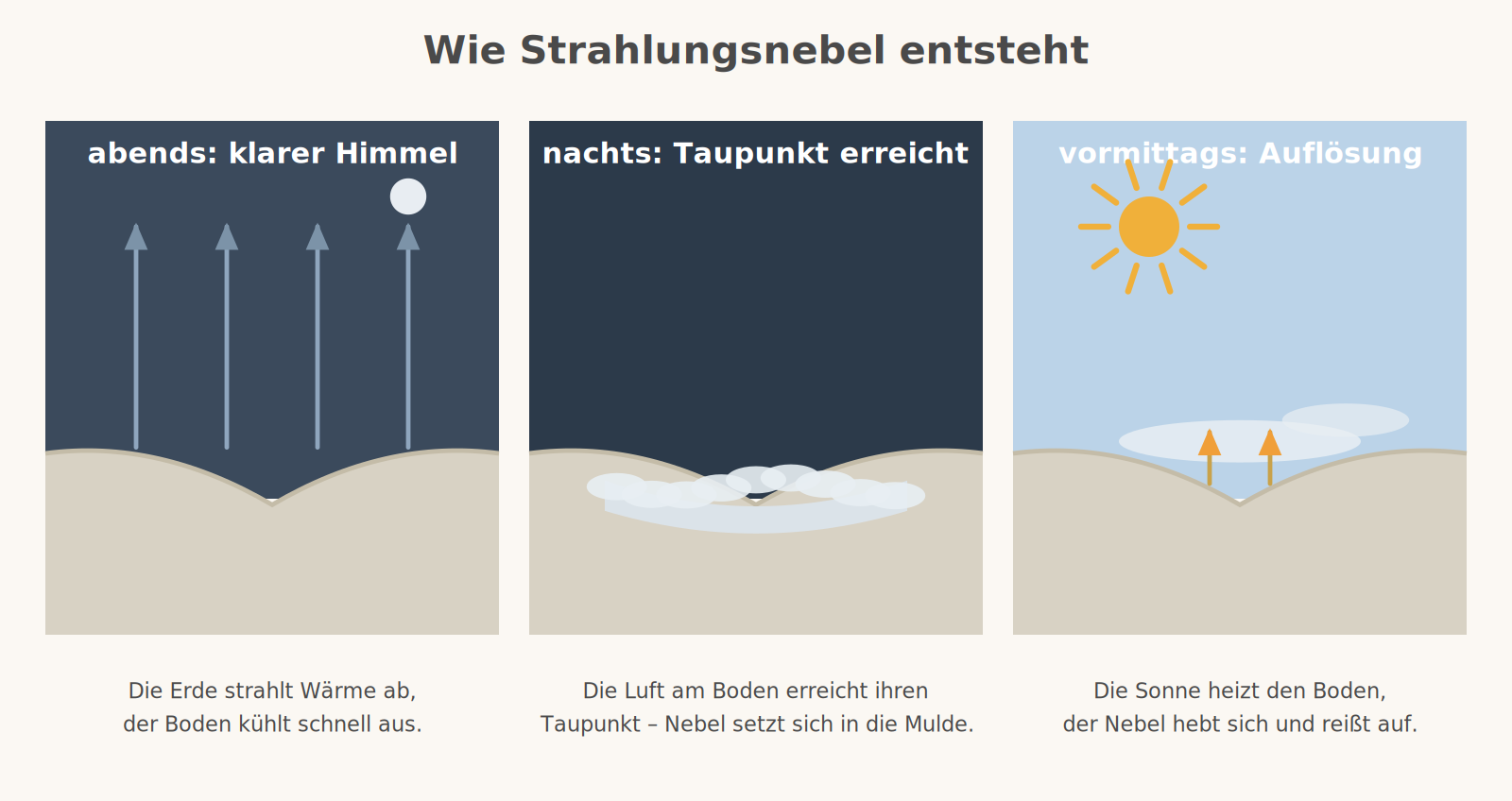
In the morning the sun warms the ground again, the air heats up and the fog clears – sometimes within minutes, sometimes not until the afternoon, in winter not at all. A little wind helps: it mixes in drier air from above. Too much wind prevents radiation fog altogether.
The other types of fog
- Advection fog forms when mild, moist air flows over cold ground – typically over snow in late winter. It persists even in wind and hardly clears with the sun.
- Low stratus is stratus whose base does not quite reach the ground. Under a winter high it lies as a solid deck over the Alpine foothills for days, while the sun shines at 1,000 metres.
- Haze is not fog but turbidity caused by fine particles and moisture. It reduces visibility to a few kilometres without a single cloud in the sky – especially under an inversion.
The spread also tells you the cloud base
The same number answers a second question. Rising air cools by about 3 degrees per 1,000 feet, while its dew point drops by only half a degree. The gap therefore closes at about 2.5 degrees per 1,000 feet – which gives the rule of thumb: spread times 400 feet gives the base of cumulus cloud above ground.
An example: temperature 12 degrees, dew point 6 degrees, so a spread of 6. Six times 400 is about 2,400 feet above ground. For the question of whether today's cumulus base is above or below the ridgeline, this accuracy is perfectly adequate – and you can work it out in your head on the ground before you even open the first weather report.
What this means for a flying day
- Visibility from above is worse than from the ground. On the ground you look through a few hundred metres of haze; on the approach you look obliquely through several kilometres of it.
- Into the sun, visibility disappears. The same haze layer is usable with the sun behind you and almost impenetrable into the sun – a reason to think about the landing direction too.
- After the fog it does not always get better. When it clears, a deck of low stratus or a thick haze layer often remains.
- In the evening it comes back quickly. Anyone who takes off in clear air at 5 pm in autumn may find a solid fog layer over the home airfield at 6:30.
- Two numbers are enough for a first assessment. If temperature and dew point come within two degrees of each other during the day, fog is on its way.
Remember
Clear night, little wind, small spread – there will be fog in the morning.